Thursday, March 20, 2014

Chapter Ten - The Coastal South

The Coastal South region of the United States encompasses the land and offshore islands along the coast of the Atlantic Ocean and the Gulf of Mexico, extending south from Virginia to south Texas. The region therefore includes: all of Florida, parts of Louisiana, Alabama, Texas, Georgia, Mississippi, North and South Carolina, and Virginia.  The Coastal South is part of the Atlantic Coastal Plain, which extends all the way to New York City.

Climate
The Coastal South experiences a humid, subtropical climate, with long, rainy summers and mild, wet winters.  In winter, snowfall and freezing temperatures are generally absent throughout much of the region.  This climate allows for the production of frost-intolerant products, such as citrus fruits.  The Coastal South experiences many thunderstorms annually, which tend to generate significant amounts of rainfall, and lightning in the area kills hundreds of residents per year.  
Florida orange groves
Settlement
Much like New York City, Galveston, Texas was a center for immigration.  It was a port of entry for tens of thousands of immigrants, many of whom were from Germany,  into the United States from the 1840s to the 1920s.  Galveston is therefore known as the Ellis Island of the Coastal South.  

Recreation & Tourism
NYC is known as the nation's business and financial hubbub - but the Coastal South region is famous for its recreation and tourism industries.  Millions of tourists are drawn to this region every year by the numerous resort communities and attractions, the most well-known of which is Walt Disney World.  
The presence of Walt Disney World alone, not taking other Disney-owned parks and other non-Disney enterprises located in the immediate area, increased the tourism of Orlando, Florida by ten-fold within twenty years of its opening.  

Works Cited - 
"The Coastal South." The Geography of North America: Environment, Culture, Economy. Pearson
     Education, Inc., n.d. Web. 20 Mar. 2014. <https://reader.cafescribe.com/reader/Reader.html?
     activationToken=LTSEV25ZSS7F2EK2&credential=K9ZJQ16J>.


Thursday, March 13, 2014

Chapter Nine - The Inland South

The Inland South is a very large region of the southeastern United States, including Virginia, West Virginia, North/South Carolina, Kentucky, Tennessee, Alabama, Georgia, Mississippi, Arkansas, and portions of Louisiana, Texas, Oklahoma, and Missouri.  This region also encompasses portions of the Atlantic Coastal Plain, the Piedmont, the Appalachian Mountains, and the American Central Lowland.

The Inland South is known for its weather to be hot and humid.  Winters are usually mild, but the region experiences precipitation year-round, particularly in the spring and summer months.  The Inland South is also notorious for its flash floods, which plague the region more than any other natural disaster.


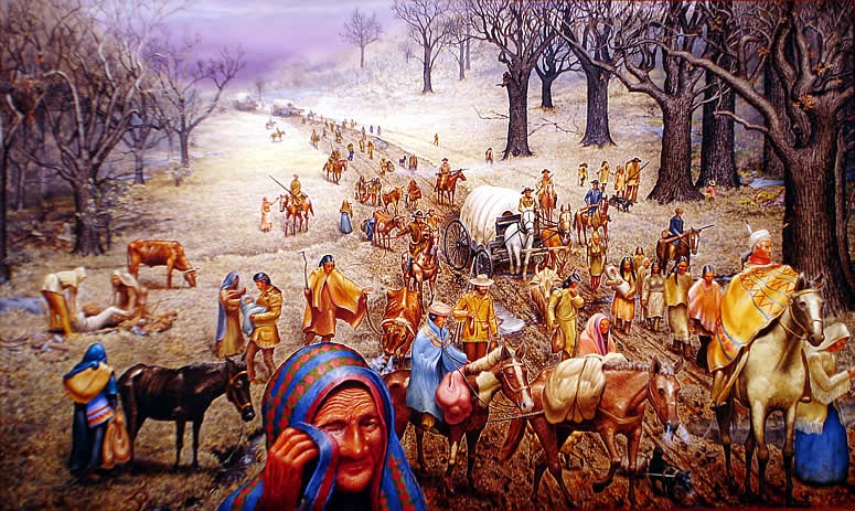
The Inland South was home to many members of the Native American population, both before and after their removal on "The Trail of Tears."  The region later became the economic center of the nation during the American Revolution, as it utilized slave labor to produce and export mass quantities of cotton, as well as other goods.


Works Cited -
http://cascourses.uoregon.edu/geog471/pdfs/Topic12Inlandsouth.pdf

Thursday, March 6, 2014

Chapter Eight - The Great Lakes & Corn Belt

The Great Lakes and Corn Belt are the heartland of America, due to its central location in the United States.  This label is placed on this region, particularly the state of Ohio, due to the fact that it is "at the heart of it all" (being the United States).

The Great Lakes-Corn Belt region of the United States encompasses the areas adjacent to and south of the Great Lakes, as well as eight US states (Ohio, Indiana, Michigan, Illinois, Iowa, Wisconsin, Indiana, Minnesota), and the southern portion of Ontario, Canada.  Because of this region's location, the area's economy is highly integrated and diverse.  

The Great Lakes-Corn Belt includes the region's largest city, Chicago, which is very similar to New York City.  Both are considered to be the metropolitan centers of their respective regions, with transportation connections extending to all over the world.  Chicago and New York City alike are influential global financial and commercial centers.  
Chicago

Like NYC, Chicago has many ethnic enclaves, including Little Italy and Chinatown, creating a diverse and unique living space.  
Little Italy, NYC

Works Cited - 
http://cascourses.uoregon.edu/geog471/pdfs/Topic12Greatlakescornbelt.pdf

Friday, February 28, 2014

Chapter Seven - Megalopolis

The Northeast Megalopolis is the most densely populated region in the United States, including the five major cities of Boston, Philadelphia, Baltimore, Washington, and New York City.


Geography
Despite this region's population, it is concentrated into an area of about fifty thousand square miles, less than the size of the state of Illinois.  Megalopolis spreads across three physiographic regions in the Northeast: the Atlantic Coastal Plain, the Piedmont, and the Appalachian Mountains.  

Population
Megalopolis, aided by the strategic placement of Ellis Island in NYC, is the home to a wide immigrant population.  Megalopolis became a "landing wharf for European immigrants," creating significant diversity throughout the region.  Areas such as Little Italy and others sprung up around these city centers, creating a culture within Megalopolis all its own.


Climate & Weather
The climate in Megalopolis is moderate, with precipitation throughout the year.  The southern portion of Megalopolis is more humid in its subtropical climate, with hot, humid summers and mild winters.  The northern portion of Megalopolis observes a winter that is much longer and colder, and a summer that is much shorter and cooler.  Hurricanes are a major meteorological threat to this area.  
NYC Financial District

New York City is one of the five major cities included in the Megalopolis region of the Northeastern United States.  NYC remains the largest city in not only the United States, but in the world.  It is also the largest and most influential financial center across the globe, which plays a significant role in its inclusion in the Megalopolis region.  With a population of over nine million, and an additional eight million in its immediate surrounding areas, New York City is a major hubbub of Megalopolis.

Works Cited -
http://www.geog.nau.edu/courses/alew/gsp220/text/chapters/ch4.html
http://en.wikipedia.org/wiki/Northeast_megalopolis

Friday, February 21, 2014

Chapter Five - The Atlantic Periphery

The Atlantic Periphery includes Newfoundland, Labrador, Nova Scotia, Prince Edward Island, New Brunswick, Maine, New Hampshire, Vermont, and the eastern portion of New York State.  Therefore, New York City is located just outside of the Atlantic Periphery.

The area experiences weather similar to that of the northern Megalopolis, in which NYC is included - cool, mild summers and cold, snowy winters, with year-round precipitation.  

The Atlantic Periphery, in being considered a "peripheral" area, has a weak economy, and must rely upon the policies and decisions of stronger economies, such as that of Megalopolis.  New York City is considered to be a main portion of the Megalopolis of the New England area, and so acts as one of the economies which the Atlantic Periphery relies upon.  

The economy of the Atlantic Periphery is weak due to the lack of natural resources, marginal agriculture, and relative isolation.  But since NYC is adjacent to the Atlantic Periphery, there are often many spillovers between the two.  Such spillovers are evident in terms of tourism, second-home development, and permanent in-migration.  

Works Cited - 
http://newyorkgeo321.weebly.com/the-atlantic-periphery.html

Thursday, February 13, 2014

Chapter Four - Political Economy

Agriculture
New York City is not necessarily a place you would expect urban agriculture to thrive - it is one of the most densely populated cities in the United States.  And yet, NYC is a leader in the practice of urban agriculture.  The city's urban agriculture community includes not only farmers and gardeners, but also school principals, sanitation workers, bodega owners, and public housing residents, as well as city officials, support organizations, and foundations.
New York City is host to two hundred, forty-five institutional farms, three commercial farms, three hundred, ninety community gardens, and seven community farms, total.
Community Garden

Institutional Farm
Economic Base
New York City is the core of international finance dealings and the global center of corporate headquarters in finance and services, real estate, media, entertainment and telecommunications, manufacturing, and trade.  Financial service jobs, though, are currently on the decline, as New York City is quickly becoming an international technological hubbub, particularly in what is being termed "Silicon Alley" - Upper Manhattan, Brooklyn, Queens, and Staten Island.
NYC currently leads the country in the number of Fortune 500 companies headquartered there, including eight of the world's top ten securities firms, and about two-fifths of the country's fifty leading law firms, as well as two hundred, nineteen banks representing every major global player.  The city's biggest industry is publishing, with more printing plants than anywhere else in the United States and employing approximately thirteen thousand individuals.  

New York City's clothing industry is headquartered in the Garment District near Times Square, where hundreds of factories employ more than one hundred thousand persons.  
NYC Garment District

7th Avenue (Fashion Avenue)
Works Cited -
http://www.urbandesignlab.columbia.edu/?pid=nyc-urban-agriculture
http://www.city-data.com/us-cities/The-Northeast/New-York-Economy.html


Wednesday, February 5, 2014

Chapter Three - Settlement

European settlement began on 3 September 1609, when Englishman Henry Hudson, in the employ of the Dutch East India Company, sailed through The Narrows into Upper New York Bay, searching for a westerly passage to Asia.
Henry Hudson
Hudson's report on the abundance of beavers in the city, at the time a high end fashion trend across Europe, served as the impetus for the founding of Dutch trading colonies in the New World, including New Amsterdam, which would later become New York City.


The Dutch West Indies Company transported African slaves as trading laborers for the area.  By the late seventeenth century, 40% of the region's settlers were African slaves. After the English took ownership of New Amsterdam in 1664, officially renaming the colony New York, they continued to import slaves from both Africa and the Caribbean.
New Amsterdam


During the American Revolution, NYC came under the control of the British, becoming its base on the North American continent until the end of 1783.
New York City served as the new nation of the United States' capital from 1785-9 under the Articles of Confederation, as well as briefly served as its capital from 1789-90 under the United States Constitution that replaced it.
Beginning in the mid-nineteenth century, waves of new immigrants arrived from Europe, dramatically changing the composition of the city and serving as workers in the expanding industries.  Home to the infamous port, Ellis Island, NYC was the gateway for millions of immigrants to the United States, and thus, New York City served as the nation's busiest immigrant inspection station from 1892-1954.
Ellis Island


Throughout its history, NYC has served as a main port of entry for many immigrants, and its cultural and economic influence has made it one of the most important urban areas in not only the United States, but the world.


Works Cited -
http://www.ny.com/histfacts/settlement.html
http://en.wikipedia.org/wiki/History_of_New_York_City